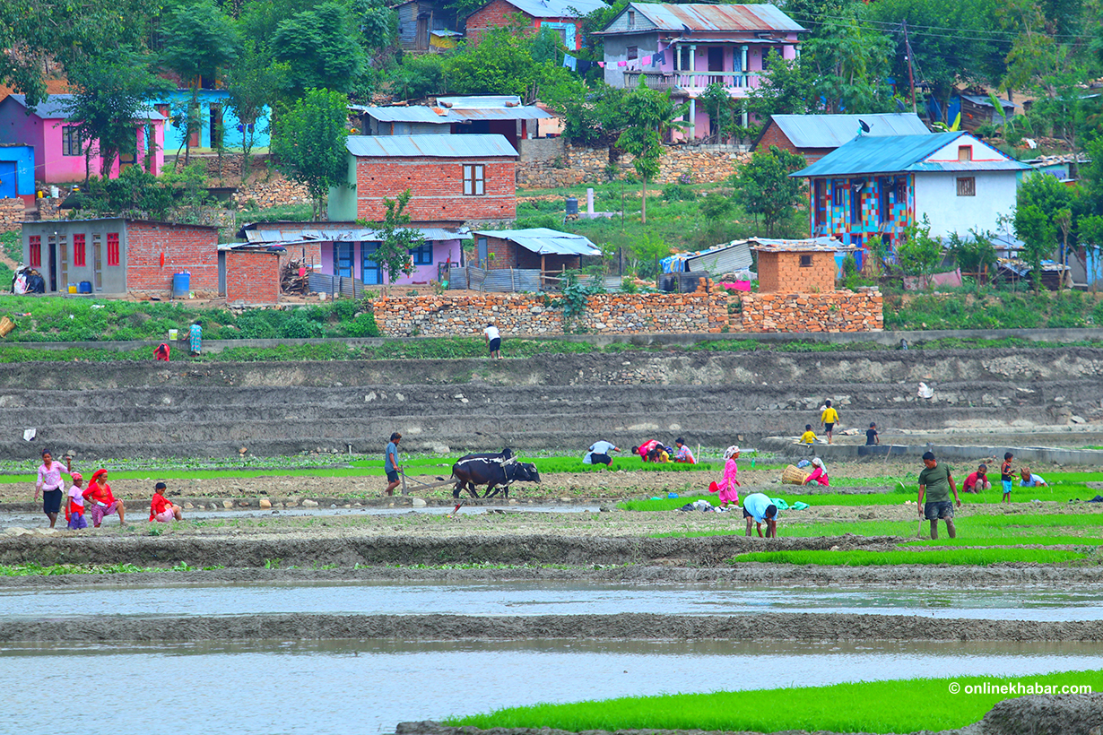
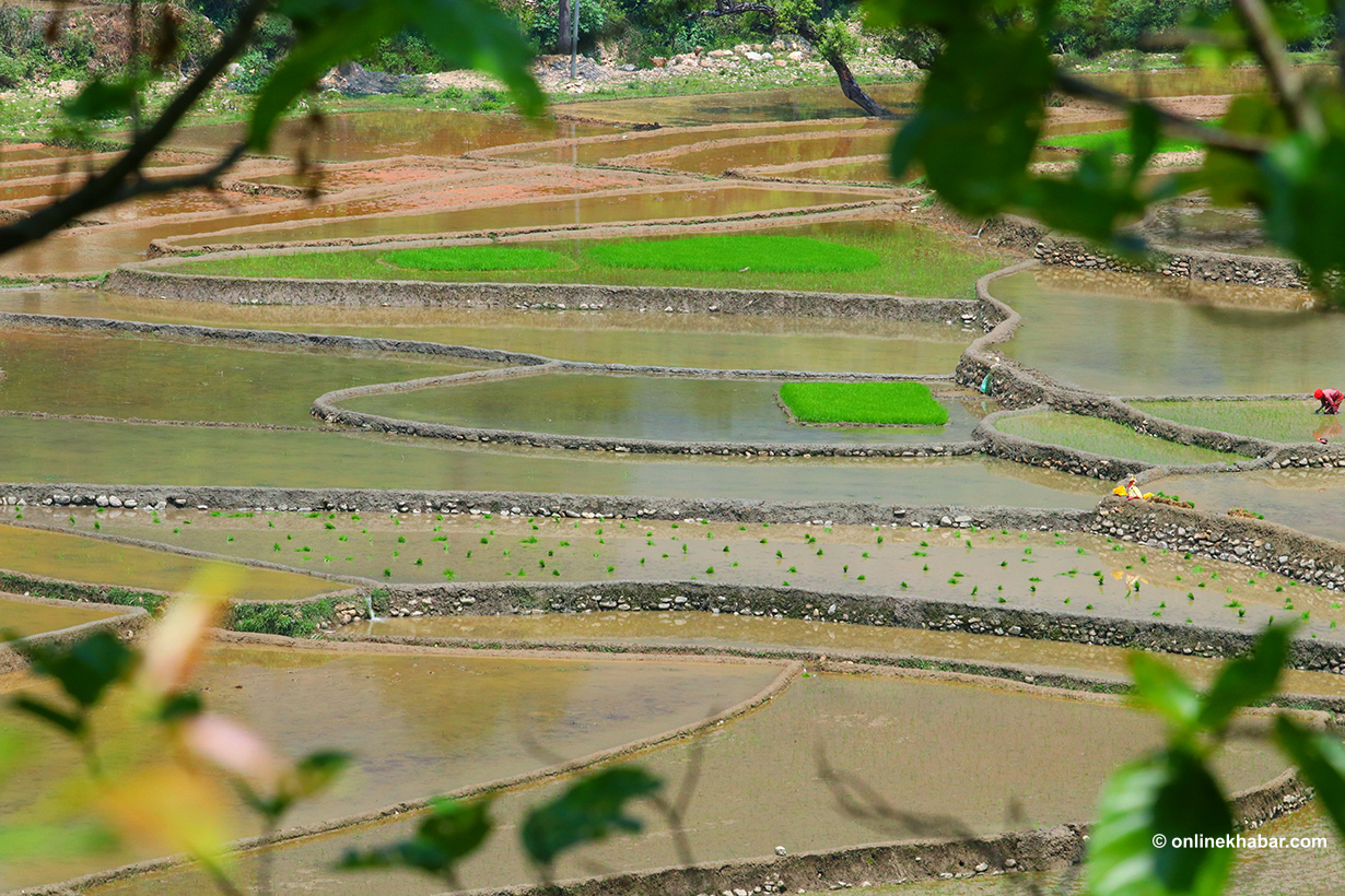
June 17, Kathmandu – Since the last week of Jestha, paddy transplanting has accelerated across various districts of the country. As the month of Asar begins, transplanting activities take off nationwide.
In regions with sufficient water availability, paddy transplanting has been extensive. However, some areas still await adequate rainfall, preventing farming activities.
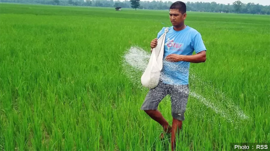
During the main paddy transplanting season, chemical fertilizer is the farmers’ most crucial requirement. While the government asserts that there is no shortage of fertilizers and releases stock data to support this claim, farmers working in the fields are reporting the opposite — they have not received fertilizers at the very start of the planting season.
Fertilizer Unavailable from Markets to Cooperatives
In Salyan district, paddy transplanting is underway, yet farmers are unable to acquire chemical fertilizers needed for their fields.
Despite government assurances of sufficient fertilizer supply, farmers in Salyan are forced to spend days searching for fertilizers.
Transplanting has started near streams and water sources, but upland terraces reliant on rainfall have not yet seen planting due to insufficient water.
Himal Yogi, a farmer from Sharda Municipality, Salyan, stated that while transplanting started as early as May 24 in lowland areas, upland regions began only mid-June.
Yogi, whose main occupation is agriculture, disclosed that there is an ongoing shortage of chemical fertilizers during the paddy transplanting season. He emphasized that fertilizers are unavailable from agricultural cooperatives to private shops.
“Fertilizer shortage is an old issue for the state; this year as well, farmers face this challenge,” Yogi said. “I have visited cooperatives and shops everywhere but could not get fertilizer. Even at the Salt Trading office, they say fertilizer is coming but nothing has arrived so far.”
He added that unlike previous years when fertilizers could be purchased from external traders despite high prices, this year even that option is closed.
Due to lack of chemical fertilizers, Salyan farmers are resorting to traditional manure such as cow and goat dung and decomposed green matter called ‘Asuro.’ However, this is insufficient for large-scale planting. Yogi mentions he requires two bags of urea and one bag of DAP fertilizer per season for his fields.
“DAP fertilizer should be applied first to the soil during transplanting, followed by two or three applications of urea, but currently there is no fertilizer at all,” he explained. “Fertilizer must be spread before transplanting; applying it afterward is ineffective.”
000
Tilak Pun, another farmer from Sharda Municipality-15, also reported difficulties in obtaining fertilizer for transplanting. He has been searching for fertilizer for two weeks.
“I have been looking for two weeks, but cooperatives have no fertilizer,” Pun complained. “At the exact time of paddy transplanting, DAP fertilizer is needed. But even after checking Salt Trading and private shops everywhere, I have not been able to find any.”
Pun said cooperatives in the municipality have responded that fertilizer supplies are not available and may take another one to two weeks to arrive. “Only after transplanting begins do meetings take place at the district level to request fertilizer,” he noted.
Pun also faced difficulties due to fertilizer shortages even during seed preparation. “Urea fertilizer is required when sowing seeds, which was hard to obtain. I had to borrow it from others, and because of the lack of fertilizer, I have yet to repay that debt,” he revealed.
There is growing concern among farmers that fertilizer shortages will reduce paddy yields. Pun, who has practiced traditional cultivation of paddy, wheat, and maize for years, fears significant production declines without fertilizer.
“Yield won’t be completely lost without fertilizer,” he said. “But there is a big difference between fields that receive fertilizer and those that do not; the ones without fertilizer produce much less.”
Pun believes that the problem stems in part from agricultural offices not requesting fertilizers in a timely manner.
Agriculture Minister’s Assurance in Parliament
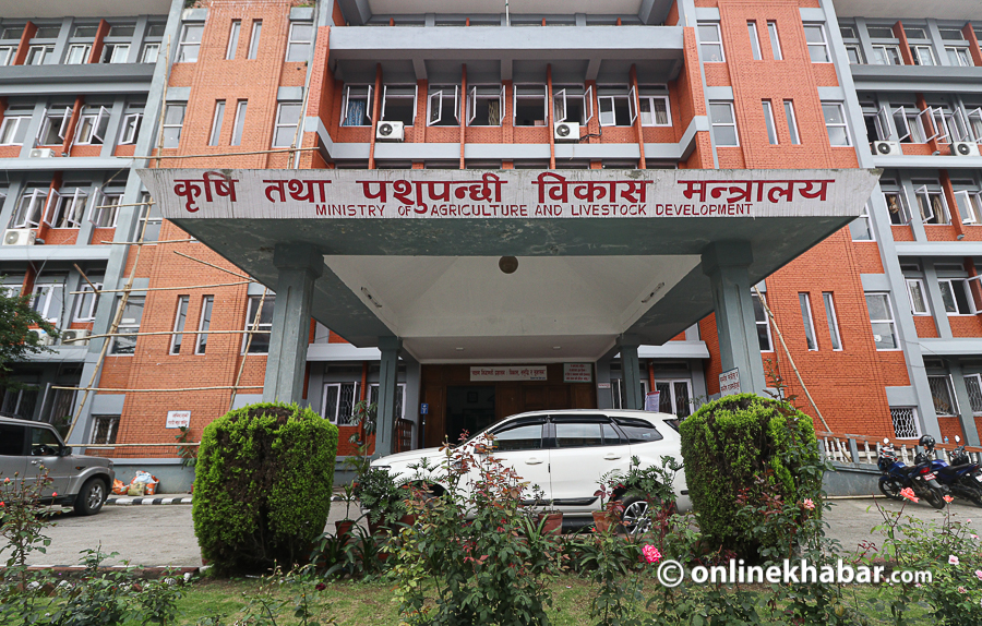
While farmer complaints about fertilizer shortages have increased, the central government claims adequate fertilizer supplies exist. On June 12, Agriculture, Forestry, and Environment Minister Gita Chaudhary stated at the National Assembly that there would be no shortage of chemical fertilizers for the paddy crop this year.

She noted that the government aims to supply approximately 600,000 tons of fertilizer as subsidies by the end of Asar, which is the highest target so far.
According to data presented by Minister Chaudhary in the National Assembly, the government currently holds a total of 138,802 tons of fertilizer: 79,318 tons of urea, 39,627 tons of DAP, and 19,857 tons of potash.
She added that out of 80,000 tons requested under the government-to-government agreement with India, procurement for 50,000 tons has already commenced, and a digital system has been implemented to ensure transparent distribution.
However, a significant gap remains between the minister’s data on ‘adequate stock’ and the reality on the ground where farmers struggle to obtain fertilizer.
Fertilizer Scarcity During Seeding in Dhanusha
Farmers in Dhanusha are currently harvesting the Chaite paddy and preparing seeds for the upcoming monsoon paddy crop. Yet, they are facing difficulties due to the lack of chemical fertilizers at this critical time.
Kusheshwar Mahto, a farmer from Bateshwar Rural Municipality-2, sowed paddy seeds about four to five days ago but only managed to use seeds due to fertilizer unavailability.
“It has been six to seven months without fertilizer. The crop did not do well without fertilizer during seed sowing,” Mahto said. “I practice animal husbandry and have used manure from cattle but could not get chemical fertilizer and still only had seeds to sow.”
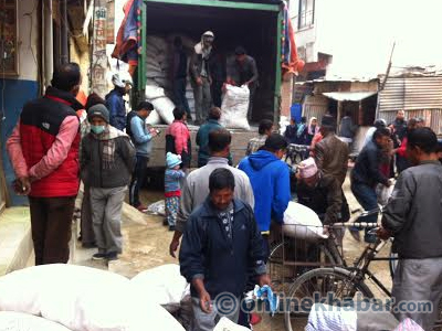
Farmers and dealers had gathered recently in Bateshwar after hearing fertilizer had arrived, but after witnessing the distribution process, many returned empty-handed.
“Just a few days ago, all dealers gathered, but only 10 bags (approximately 250 kg) were distributed in one ward,” he explained. “Since that area requires 400 quintals of fertilizer, distributing only 10 bags risks conflicts among farmers, so they refused to accept it and went back empty-handed.”
He added that the provincial office also lacks fertilizer and immediate arrival is not expected.
Mahto, who cultivates more than one bigha (0.7 hectares) of paddy, said that he needs 100 kg of DAP during sowing and 50 kg of urea twice during irrigation.
“There is no fertilizer even at seed sowing time now; I hope it will be available during transplanting. If not, we may have to endure the same predicament as the last three years,” he added.
While some farmers with irrigation have already begun transplanting, most are waiting for ample rainfall. With sufficient rain, crop seedlings in the Terai will mature within the next 15 days, intensifying transplanting activities.
Frequent fertilizer shortages during cropping seasons have worried farmers. “Farmers absolutely need more fertilizer,” he said. “No matter which government is in power, instead of protecting farmers, they are destroying them.”
Similar concerns are echoed by farmers from Dang to Rautahat and Kavrepalanchok, who worry how they will farm without timely fertilizer supply.
Similar Conditions in Dang, Rautahat, and Kavre
In Dang, fertilizer scarcity forced farmers to stand in vigil overnight. Just three days ago, a photo showing farmers lining up outside an agricultural cooperative from 11 p.m. to procure urea fertilizer for paddy and maize farming went viral on social media.
Farmers report receiving only a limited amount of fertilizer via a quota system enforced by agricultural materials companies and Salt Trading, leading to many returning empty-handed. Regular supply has been lacking since Poush (mid-December to mid-January).
Similarly, farmers in Rautahat have already prepared paddy nurseries, but due to the government’s failure to provide timely fertilizer, they have resorted to importing expensive and low-quality fertilizers from nearby Indian markets.
Similarly, farmers in Kavrepalanchok report dire situations. After government warehouse stocks depleted in Panchkhal, Mandandeupur, and Banepa, farmers were forced to buy fertilizer at higher prices through middlemen.
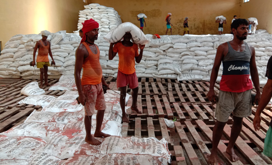
Despite Farmer Shortages, 100,000 Tons of Fertilizer Remain Stocked in District Offices
At the end of Jestha, the Ministry of Agriculture revealed data that nearly 100,000 tons of chemical fertilizer remain unclaimed in distribution management divisions across various districts under the Agricultural Materials Company Limited.
Although the central government has shipped fertilizer to district branch offices, local governments and cooperatives have failed to pick it up in time, resulting in thousands of tons being stored in warehouses.
According to figures, Madhesh Province has the highest fertilizer stock with 31,131 tons of urea, 11,456 tons of DAP, and 5,584 tons of potash available.
Bagmati Province district offices hold 4,093 tons of urea, 599 tons of DAP, and 251 tons of potash.
In Gandaki Province, 460 tons of urea, 130 tons of DAP, and 61 tons of potash remain stored. Lumbini Province district offices have 15,035 tons of urea, 4,643 tons of DAP, and 4,412 tons of potash.
Karnali Province stockpiles include 212 tons of urea, 74 tons of DAP, and 48 tons of potash, while Sudurpashchim Province district branches have 2,454 tons of urea, 293 tons of DAP, and 423 tons of potash still lying unused.
Despite sufficient fertilizer presence at district offices, distribution delays and neglect by local bodies (municipalities and cooperatives) have prevented timely fertilizer delivery during the main cultivation season.
This situation contrasts sharply with the minister’s claims of a digital information system and assurances of nondiscriminatory fertilizer access, causing frustration among farmers.
Black Market in Subsidized Fertilizer
Incidents of black marketing in government-subsidized chemical fertilizer have surfaced during the cropping season.
On April 8, 2022, police uncovered hundreds of bags of subsidized fertilizer forcefully stored and illegally marketed in areas including Sindhupalchok, Bara, and Siraha with assistance from central administration.
Investigations revealed that cooperatives, local bodies, and middlemen conspire to artificially create fertilizer shortages by hoarding fertilizer in private warehouses, selling it at inflated prices to private shops or storage facilities.
On the same day, security forces seized over 300 bags of subsidized fertilizer from two locations in Balefi Rural Municipality, Sindhupalchok.
Recently, police also recovered 87 bags of subsidized potash fertilizer hidden in a private warehouse and storage in Prasauni Rural Municipality-5, Bara district.
Investigations have found that traders mislead farmers by claiming no subsidized fertilizer availability, yet hoard supplies to sell later at up to triple the price.
Ministry of Agriculture Clarifies: Fertilizer Available in Warehouses; Distribution Hampered by Local Bodies
Following widespread complaints from farmers about fertilizer shortages during the peak paddy transplanting season, the Ministry of Agriculture clarified that fertilizer scarcity is not the issue; rather, distribution and management problems are to blame.
Ramkrishna Shrestha, Secretary at the ministry, confirmed that roughly 140,000 tons of fertilizer are stored in warehouses but due to local governments and cooperatives failing to pick up the supplies promptly, farmers have faced difficulties.
Although rumors claim the market has no fertilizer, he asserted ample stocks are present at Salt Trading and Agricultural Materials Company warehouses. The problem lies in municipalities not properly allocating quotas or recommending them to cooperatives, which results in fertilizer remaining uncollected.
Shrestha said, “There is fertilizer in stock; the problem is that some hill municipalities have not followed protocol to pick their quota, which has hampered fertilizer distribution. If they fail to collect their quota within the stipulated time, the allocation can be transferred to neighboring municipalities or districts. Because hill districts failed to pick fertilizer on time, places like Dang faced shortages, but the issue has now been resolved.”
He also stated that distribution problems from western Dhangadhi through Dang to eastern Kavre have been addressed by coordinating dealers, cooperatives, and farmers together, implying that not all complaints are entirely accurate.
The ministry also claimed some farmers complain of lack of fertilizer even after receiving it.
Excessive Fertilizer Usage in Madhesh, Low in Gandaki
According to ministry figures, about 28-29% of the country’s total fertilizer consumption occurs in eight districts of Madhesh Province alone.
“Average fertilizer use in Madhesh has reached 218 kg per hectare, which exceeds the rate in India, while Gandaki Province’s average is only 40 kg per hectare,” Secretary Shrestha said. “This excessive use raises concerns over soil degradation and loss.”
Black Marketing and Pressure from Hybrid Seed Demand
To avoid black marketing during winter fertilizer shortages and risks during the main paddy season, the ministry has implemented some controls on fertilizer distribution. However, fertilizer demand remains very high during cropping seasons, Shrestha admitted.
During the paddy season (Jestha to Ashwin), approximately 45% of the annual demand for fertilizer—around 245,000 tons—is required, necessitating centralized management and strategic planning.
The recent widespread cultivation of hybrid maize, hybrid paddy, and potatoes has unnaturally increased fertilizer demand. The ministry has sent official letters to district administrations warning them to enforce strict action against black marketers, middlemen, and cooperative malpractices.
“If there are irregularities in the subsidy fertilizer system, district chiefs have the authority to impose jail sentences,” Shrestha added.
Fertilizer demand is so great in Nepal that the government does not have enough to meet it.
Due to a war involving the US, Israel, and Iran, global tensions are disrupting supply routes like the Strait of Hormuz, preventing fertilizer imports through global tendering. The last batch of fertilizer has been distributed in provinces and municipalities according to quotas and is now exhausted. The ministry has stated that new fertilizer shipments through government-to-government arrangements with India will begin arriving only toward the end of Asar.